| |
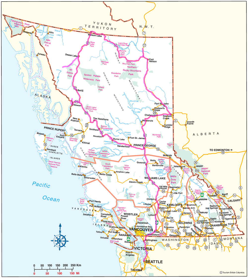
The route I followed is highlighted on this map in maroon. From Seattle it follows I-5 north to near Bellingham, where I headed northeast to the Sumas border crossing, then on to Route 1 from Abbotsford to Hope and Cache Creek. From Cache Creek I continued north on 97 to Prince George and eventually Dawson Creek, where 97 becomes the Alaska Highway and turns northwest. Just west of Nelson I headed north for a while on the Liard Highway (Route 77) to try to get to a park to camp, but it turned out the park was not accessible from the Highway, so I headed south again and camped on the Alaska Highway just west of the junction with the Liard. From just west of Watson Lake I headed south on the Stewart-Cassiar Highway (37), and in Dease Lake I turned southwest on the Telegraph Creek Road (not marked on the map, but roughly highlighted). After returning to Dease Lake I continued south to 37A, which took me to Stewart and Hyder (located in the same place as Stewart but on the Alaska side of the border). I drove past Hyder (again not marked but roughly highlighted) to the glacier overlook, and returned to 37 south the next day. From the junction with 16 I headed east, back to Prince George, and then south on the same route I had driven north.
|
|